What Do We Really Know About Antarctica?

The sheer vastness of Antarctica is stunning. Despite it being the fifth-largest continent, containing 70 percent of the world’s fresh water in its glacier, it remains largely unexplored – not to mention what lies beneath the ice.
The documented discovery of Antarctica is somewhat ambiguous as far as crediting one particular person, but it has been generally accepted that it occurred around 1820. However, there have been alternative theories positing that the continent may have been discovered centuries earlier by ancient civilizations – possibly influenced by extraterrestrial technology.
1513 Piri Reis Map during the Ottoman Empire
The evidence of an earlier discovery of Antarctica is thought to be found in the Piri Reis Map, created by the Ottomans in 1513 shortly after Columbus’ discovery of the Americas. The map was drawn by a cartographer of the same name who claimed to have drawn the map, not from his own personal knowledge and expeditions, but from more than 20 source maps already available to him in Turkish libraries at the time. He also stated that these maps predated the reign of Alexander the Great (356 -323 BC).
The map was unexpectedly discovered in a library Constantinople in 1929. This map was drawn to such accuracy that it depicted the coastlines of South America and Antarctica within half a degree of longitude.
The extent of their mapping of the continent is seemingly more advanced than early cartographers were capable of creating.

A Warmer Continent
Dr. John Weihaupt, an emeritus professor of Geology at the University of Colorado Denver, was a proponent of the belief that Antarctica was discovered significantly earlier than we’ve been told, though the actual means of discovery, he claims are unknown.

According to some, the Piri Reis map appears to show the subglacial topography of Antarctica during a time of warm weather that harbored life. A study by scientists from LSU and Rice University found deposits of pollen fossilized in layers of sedimentary rock, showing signs of a tundra warm enough for plant growth as recently as 12 million years ago.
However, theories focusing on the Piri Reis Map would suggest a warmer Antarctic climate much more recently.
Pyramids and Odd Structures
The discovery of several four-sided pyramids has ignited another curiosity as to the mysticism surrounding Antarctica. Some claim that the pyramids could be the work of ancient or alien civilizations, while others say that they are simply nunataks —protruding peaks of mountains buried beneath the ice, shaped by erosion. However, the distinctly shaped sides of each face are what alternative theories see as evidence of the pyramids being man-made. An additional dome-shaped structure protruding from beneath the ice has raised further questions and perpetuated the belief of an ancient civilization buried beneath that the Ottomans may have been aware of or contacted.

Google Earth view of Antarctic pyramids

Dome appearing to have multiple cells protruding from ice in Antarctica
Underground Tunnels and Military Bases
An image showing what appears to be several tanks and a downed aircraft have added to the prospect of government military action or secret bases on Antarctica. During WWII there was evidence, some rumored and some confirmed, of Nazi military programs that established bases on the continent, supposedly researching extraterrestrial technology. Conversely, during a naval expedition dubbed, Operation Highjump, Rear Admiral Richard E. Byrd is purported to have been exposed to extraterrestrial technology.
Some interpret Byrd’s claim of seeing aircraft that “are able to fly from one pole to the other with incredible speed,” as a UFO sighting, whereas others interpret it as a warning of the possibility of an attack from planes subversively flying over the poles to reach their targets without detection. However, both of these interpretations seem to hint at Nazi activity on Antarctica.

An image appearing to show tanks facing unknown craft
About the Author
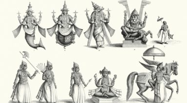
Sirians: Who Are They And What Is Their Connection To Earth

The Sirians are star beings from the Sirius system, one of the brightest stars in the sky and deeply symbolic in many ancient cultures. They are associated with a high spiritual frequency, ancestral wisdom, and a direct influence on humanity’s evolution. In this article, we explore who are the Sirians, where they come from, and how they are linked to Earth’s spiritual history.
Table of Contents
- Who Are The Sirians And Where Do They Come From?
- Spiritual And Energetic Characteristics Of The Sirians
- The Spiritual Mission Of The Sirians With Humanity
- Incarnated Sirians: How To Recognize Their Presence On Earth
- Relationship Between Sirians, Pleiadians, And Arcturians
- How To Connect With Sirian Energy
- How To Know If Your Soul Originates From Sirius
Who Are The Sirians And Where Do They Come From?
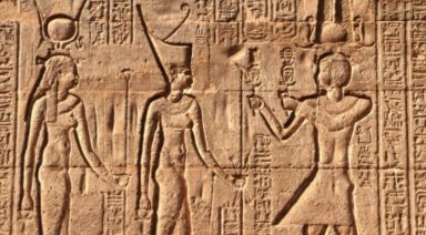
Sirians are beings of light from the Sirius star system, located in the Canis Major constellation. This star was seen as a spiritual reference point by ancient cultures like the Egyptians, Sumerians, and Mayans, who associated it with advanced knowledge and a direct connection to higher realms. The Sirians belong to a highly evolved civilization that has guided humanity since its beginnings, offering wisdom and assistance at key moments in human development.
These beings operate from elevated levels of consciousness and actively collaborate in the planet’s evolutionary process. They have transmitted essential knowledge about sacred geometry, vibrational healing, energy technologies, and the integration of body, mind, and spirit. Their presence is often felt through dreams, meditations, and intuitive experiences, guiding those in the process of spiritual awakening and reconnection with their cosmic origin.
In Gaia’s series Deep Space, researchers explain how beings from Sirius could be related to ancient civilizations on Earth, pointing to evidence in Egyptian hieroglyphics and the star charts of the Dogon tribe from West Africa.
Spiritual And Energetic Characteristics Of The Sirians
The Sirians possess very high vibrational qualities and are deeply connected with cosmic wisdom. Their energy manifests through harmony, spiritual knowledge, and the capacity for deep transformation. Below are some of their main characteristics:
- Connection with water: Their energy is linked to this element, symbolizing emotional flow and ancestral wisdom. They often connect with Earth through oceans, lakes, and dolphins.
- Advanced spiritual technology: They manage knowledge that integrates science and spirituality. They have developed technologies based on frequencies, crystals, and sacred geometry.
- Telepathic communication: They communicate through the mind and heart. Their language is vibrational and can be received during meditation or in expanded states of consciousness.
- Masters of sacred geometry: They use geometric forms to activate energetic portals and harmonize spaces. They teach how to apply them for personal and planetary balance.
- Vibration of service: Their main intention is to guide, heal, and collaborate with the beings’ evolution. They work from subtle planes to support collective awakening.
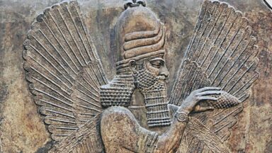
- Connection with ancient civilizations: They are linked to cultures such as Atlantis, Egypt, and Lemuria. Through them, they sowed fundamental knowledge for humanity.
- Subtle but constant presence: Although they are not always visible, their energy can be felt at key moments of transformation. They act as silent guides of spiritual awakening.
The Spiritual Mission Of The Sirians With Humanity
The mission of the Sirians is deeply tied to the awakening of consciousness on Earth. Their main purpose is to collaborate in the planet’s evolutionary process, driving inner transformation, energetic activation, and reconnection with the soul’s purpose. Through their guidance, many people have opened up to new forms of understanding existence, energy, and the origin of being.
The Sirians act as guardians of universal wisdom, transmitting knowledge that helps reestablish balance between rational mind and intuition. They have influenced the development of advanced civilizations and the energetic configuration of sacred sites. Their presence has been key during planetary transitions, offering tools to face the challenges of change from a place of alignment and clarity.
Moreover, they foster the union between the spiritual and the material, encouraging a life of greater awareness, coherence, and responsibility. Their mission also includes the strengthening of collaboration networks among like-minded souls, the promotion of new forms of education, and the integration of ancestral knowledge into daily life. Through their guidance, they aim to ease the path toward a more awakened humanity, connected to its essence and aligned with the evolutionary cycles of the universe.
Incarnated Sirians: How To Recognize Their Presence On Earth
Many beings from Sirius have incarnated in human bodies to directly support collective transformation from the physical plane. Although they are not always aware of their origin, their energy and purpose are clearly reflected in their actions, interests, and perception of reality.
- Heightened energetic sensitivity: They easily perceive the vibrations of people and environments. They tend to need calm spaces to remain balanced.
- Deep interest in spirituality and the ancient world: From an early age, they are drawn to topics like sacred geometry, ancestral civilizations, and the mysteries of the universe. This attraction often intensifies during personal crises or times of inner searching.
- Sense of not belonging: They often feel that Earth is not their true home. This feeling is accompanied by a strong need to understand their purpose in this life.
- Natural healing ability: Many develop skills in energy therapies, meditation, or practices related to mind-body balance. Their presence has a harmonizing effect on others.
- Commitment to service: They have an inner drive to help, teach, or guide others. Their mission is oriented toward raising collective consciousness and building a more coherent and loving world.
Relationship Between Sirians, Pleiadians, And Arcturians
The Sirians, Pleiadians, and Arcturians are part of a network of star civilizations that actively collaborate in the evolutionary process of humanity. Each of these races contributes a unique frequency and complementary knowledge that together support the awakening of collective consciousness on Earth. This interstellar cooperation is not recent; it dates back to the origins of our spiritual history.
The Pleiadians, for example, work with the energy of unconditional love, emotional healing, and energetic body alignment. The Arcturians bring advanced spiritual technology, wisdom in frequency management, and guidance for developing multidimensional consciousness. The Sirians, meanwhile, serve as bridges between these frequencies, offering structure, cosmic vision, and connection to ancestral knowledge.
Although each group has its own mission, their energies do not compete with each other but integrate harmoniously. Many souls incarnated on Earth have ties to more than one of these civilizations and may feel affinity or connection with their different teachings. Recognizing this support network is key to understanding the depth of the process humanity is currently undergoing.
How To Connect With Sirian Energy
Connecting with Sirian energy requires openness, clear intention, and a willingness to work from subtle planes. Their frequency can be perceived in moments of deep silence, during spiritual practices, or through intuitive experiences. Here are some effective ways to establish this connection:
- Meditation in water: Meditating near the ocean, rivers, or in salt baths helps tune into their vibration. Water is a natural channel for their frequency.
- Working with sacred geometry: Drawing, visualizing, or meditating with shapes like the star tetrahedron or Metatron’s Cube facilitates connection. These forms act as energetic keys.
- High-frequency sounds: Listening to isochronic tones or frequencies associated with Sirius, such as 963 Hz, helps open channels of subtle perception. These sounds raise vibration and attune the energy field.
- Intuitive writing: Practicing automatic writing in a meditative state allows symbolic messages or images to emerge. It’s a common communication path with Sirian guides.
- Conscious invocation: Before sleep or during meditation, you can directly ask for guidance from Sirian beings. A clear and respectful intention is enough to open the channel.
How To Know If Your Soul Originates From Sirius
Many people feel a deep connection to the stars without knowing exactly where it comes from. When a soul originates from Sirius, internal signs often emerge, such as a strong attraction to the cosmos, a sense of spiritual mission, and a special sensitivity to subtle energies. These signs arise naturally throughout life, especially during transformative moments.
It is also common to experience a sensation of not belonging or nostalgia for a place that can’t be identified on Earth. People with Sirian origins often have a deep perception of reality, a need to understand the purpose of existence, and a drive to transform their surroundings through service, teaching, or healing.
Consulting with an Akashic Records reader is a powerful way to explore your soul’s journey and possible star origin. A reading with an Akashic Records practitioner can help you understand if your soul has ties to Sirius and what purpose it carries for this incarnation. Recognizing your spiritual lineage not only brings clarity, but also strengthens your connection to the path you came to walk on Earth.