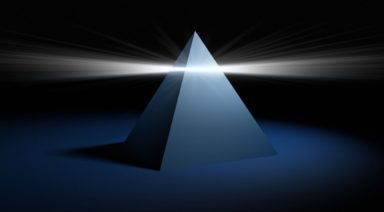
Laser Scanning Reveals Mayan Complex Hidden for Centuries

Laser mapping reveals nearly 500 ancient ceremonial sites hiding just under the landscape of modern-day Mexico and leads scientists to revise their understandings of the origins of the Maya Civilization.
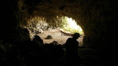
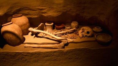
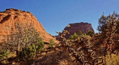
Eastern Mexico is home to the ancient Maya, renowned for their striking pyramids, written language, and complex calendar system. It is there that scientists first discovered Aquada Fénix, the largest and oldest-known Mayan construction.
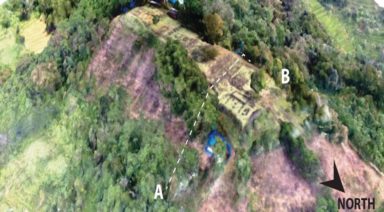
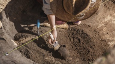
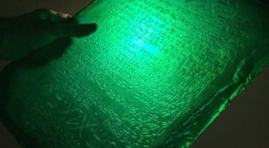
Professor Takeshi Inomata is an archeologist at the University of Arizona who led the study. “We did LiDAR, which is an airborne laser marking technique. Using this technique we found Aguada Fénix, which is the oldest monumental construction in the Maya area,” Inomata said. “It has a huge artificial plateau which has a perfect, rectangular shape measuring 1.4 km long and 400m wide, which represents the largest construction in the entire Maya history. It dates to probably 1,100 – 700 BC, which makes it the oldest monumental construction in the Maya area. So the interesting part is that the largest building happened at the very beginning or oldest stage of Maya civilization.”
Having made this extraordinary find, the team recently expanded their search to a broader area using the same cutting-edge LiDAR technology. They were specifically hoping to find sites built by the Olmec people, an older civilization thought to have influenced the development of the Maya. What LiDAR revealed was groundbreaking.
“We found nearly 500 ceremonial complexes, which look like Aguada Fénix, although they are not as big. This distribution shows they shared similar concepts of space, ritual, and probably worldview. It tells us the people in the Olmec area and the Maya area really exchanged ideas and that kind of interaction was very important for the initial development of Mesoamerican civilizations,” Inomata said.
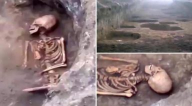
“This is the earliest evidence for the gathering of a really large number of people. Those people probably did not have too many hierarchical organizations, they most likely did not have kings. They didn’t have much marked social inequalities, so those people gathered and organized themselves, then made these huge constructions. This really makes us think about the development and possibility of human societies, not just about Mesoamerica, but about human societies in general.”
Freddy Silva is a researcher and author who has extensively studied these ancient people, tracing their routes to a much older civilization.
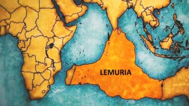
“There was a big remnant of a very large civilization, which began after this island continent in the middle of the Eastern ocean, called ‘Atl’ back in the day, sank and we received the survivors in 9,600 BC,” Silva said. “It’s a very specific date at the end of the great flood, but it’s not just that they came from the Atlantic, the survivors also came from the Pacific. So now we’re looking at something much bigger as a story because not only are these cities being discovered by LiDAR as a remnant of a civilization that came from the East, they also came from the West as well; we have the migration of two different groups of people which made up the Maya culture into what it became.”
What is known about these groups of people?
“These people arrived in groups of seven, there were various teachers who were experts in their field. These were people who were really more into the nuts and bolts of what the spiritual system was all about, they would know more than the average person,” Silva said. “So, they became part of a priesthood that was open to men, women, and anyone who was curious, and they would spend years, anywhere between five to 10 years learning the mysteries. These are people who settled down and spread the culture across the whole of Yucatan and into Guatemala, and I quote, ‘[A]s a mirror image of the sunken homelands of the Gods.’ So what we see today in the jungle are essentially copies of the originals which are now thousands of feet under the ocean.”
Much more remains to be known about the history of these fascinating civilizations and plans are underway for further research.
“You can’t get away from digging. Discovering the past is a very difficult and time-involved process, as a researcher, I can tell you it’s not easy unless you look at the past from different lenses.” Silva said “You have to look at it from the point of view of mythology, folklore, climatology, and how people were thinking at the time, and that requires talking to a lot of people with an open mind to bring a kind of consensus. From my part, I would like to see the LiDAR and the archeology go to the deepest parts of Guatemala because that’s where the Itz (Mayan people) eventually settled. And I suspect as this LiDAR becomes more of a tool we’re going to find some very big news coming out of Guatemala, Belize, and even further south. This is just the tip of the iceberg as far as I’m concerned.”
Ancient Protection: Using Apotropaic Magic to Ward Off Evil
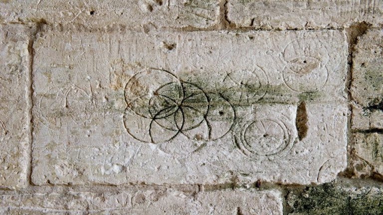
Ancient cultures regularly called upon the powers of magical, or apotropaic, symbols and rituals to guard them and their loved ones from evil. While some of these images seem to have faded into obscurity, one can still find them in their various forms — especially in the United Kingdom — often hidden in plain sight.
“Apotropaic” is derived from a Greek word, meaning “to ward off” or “to turn away,” and when applied to magic, it becomes an umbrella term for various symbols used on a house to keep evil from entering, as well as specific objects imbued with magical powers that protect those wearing or traveling with them.
Traditionally found engraved or etched onto, or burned into areas of entry, — especially windows, fireplaces, and doors — apotropaic symbols are seemingly commonplace on ancient buildings with inhabitants who were fearful of evil spirits. Those interested can find them on houses, barns, churches, and cellar doors.