Japan’s Yonaguni Ruins May Hold the Key to a Sunken Civilization
The mystery of the lost continent of Atlantis has puzzled researchers for centuries, as growing evidence supports the theory that an advanced civilization may have been destroyed and gone unnoticed by mainstream archeology. This antediluvian civilization is assumed to have been located somewhere in the Atlantic Ocean and is thought to have been the progenitor of ancient civilizations like those in Egypt and India. But could there have been another sunken continent from that era that predates Atlantis? The Yonaguni ruins might provide an answer.
The Yonaguni Monument
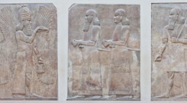
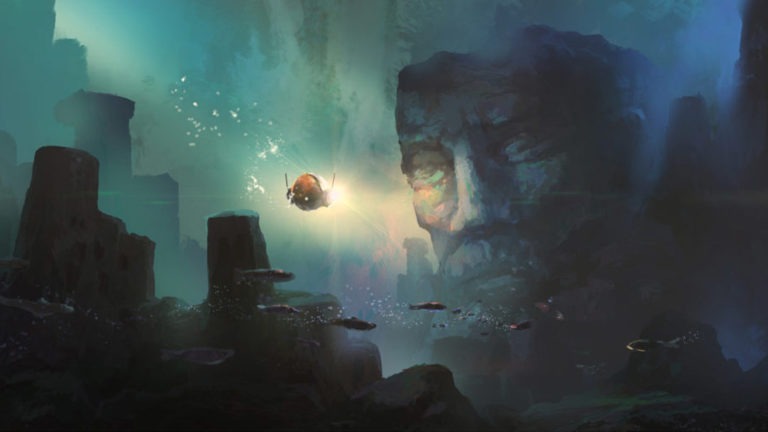
In 1985, a Japanese diver named Kihachiro Aratake was exploring the seafloor off the Southern shore of Yonaguni-Jima island, the Western-most island in the Ryukyu archipelago of Japan. Aratake came across what appeared to be the sunken ruins of an ancient, megalithic, stepped pyramid, similar to the ziggurats built in ancient Sumer. Since his discovery, the provenance of the ruins has been debated as to whether they are man-made or naturally occurring, due to the possibility of natural geological terracing.
Dr. Masaaki Kimura from the University of Ryukyu is the biggest proponent for the theory supporting the artificiality of the ruins. Surprisingly, Dr. Robert Schoch is one archeologist who has contended Kimura’s theory, despite his support for the Sphinx water erosion hypothesis. Although, Schoch has conceded that he doesn’t perceive Yonaguni to be a closed case and that he hasn’t spent as much time diving there, compared to Kimura’s 15 years.
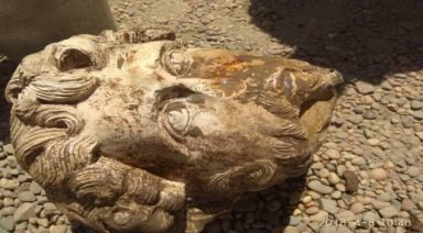
According to Kimura, the Yonaguni monument appears to depict carvings of animals and people as well as the remnants of a carved face, which he compares to the Moai heads on Easter Island. At the end of the last ice age, Yonaguni would have been connected to what is now mainland China. It is likely that the fate of the civilization that built the Yonaguni pyramid, was sealed by a massive tectonic event that triggered a tsunami and subsequent sea level rise.
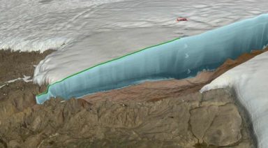
Since the end of the last Ice Age, sea levels have risen some 40 meters, causing drastic changes in topography and lending credibility to the theory that there may have been cities or even continents that disappeared into the sea. Based on stalactite found in caves near the ruins, Kimura has calculated the Yonaguni pyramid to be at least 6,000 years old when it sank, with the potential to be up to 10,000 years old including the time prior to flooding. The oldest recorded flooding event at Yonaguni occurred in the late 1700s, during which a tsunami ravaged the island with 130 foot waves. This combination of sea level rise and catastrophic climatic events were likely the cause of this ancient city’s demise.
Courtesy of www.yonaguni.ws
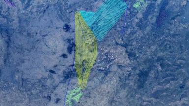
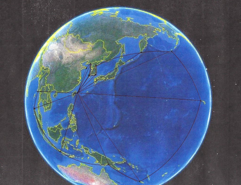
An interesting discovery has been made when looking at the orientation of the angles in the Yonaguni ruins. One researcher believes that the radial lines, when extended out from the ruins, might potentially outline a territory in the Pacific. This theory employs geoglyphology, or the study of coded maps and messaging in ancient geoglyphs, and has drawn out the radial lines of the Yonaguni ruins. The Faram Research Foundation’s work shows lines that depict a map very similar to the territory sought after by Japan during WWII.
The area extends from Yonaguni and the South China Sea, up to the tip of Alaska’s archipelago, down to Hawaii and back over encompassing Indonesia and Burma (Myanmar). This territory, some believe, could be that which was occupied by the lost continent of Mu, a lost civilization larger and older than Atlantis.
The Lost Continent of Mu
The lost civilization of Mu, is thought to have spanned a large swath of the Pacific Ocean. Reaching from the Philippines Sea all the way to Easter Island, Mu would have encompassed most of the small islands in the mid-Pacific, including Guam, Fiji, Christmas Island, Midway and Hawaii. The conception of Mu was first proposed by Augustus LePlongeon in the 19th century who was the first explorer to photographically document the ancient Mayan city of Chichen Itza. It was there that he supposedly learned of the lost continent of Mu through his translation of the ancient Mayan Troano Codex.
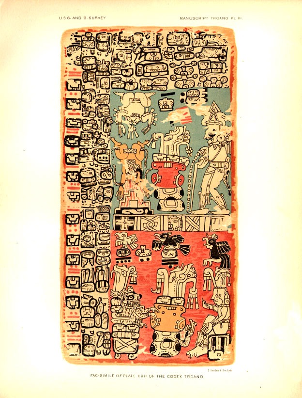
LePlongeon’s translation showed that the Mayan civilization was aware of and predated the ancient Egyptian and Greek civilizations, while also mentioning another civilization that was lost in a cataclysmic event. But LePlongeon’s account is thought to be spurious due his use of a false translation of the ancient Mayan language.
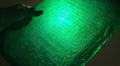
But a later account of the ancient continent from a book published in 1926, by James Churchward, is thought to possibly carry more veracity. Churchward was an English occultist who spent several decades living and studying with a group of mystic priests in India. There he was shown esoteric tablets that detailed the erstwhile civilization and its supposed 64 million inhabitants called the Nacaal, who lived roughly 50,000 years ago. The tablets contained a multitude of vignettes, or a series of pictographs that supposedly told the story of Mu. In order to properly transcribe the vignettes, Churchward had to study an ancient language called Naga-Maya, known to only a handful of people in the world.
Although it is difficult to conceive of a continent this size to have just disappeared underwater, some believe that the Yonaguni monument may be a key to the explanation. Though Churchward’s translation didn’t garner as much notoriety as the search for Atlantis, some believe his interpretation of Mu to be one in the same with the lost city of Lemuria, popularized by Russian theosophist, Helena Blavatsky. Blavatsky’s depiction of the Lemurian people shares many similarities with Churchward’s account, that she also claims to have learned from an esoteric text given to her by Indian mahatmas.
Were Lemuria and Mu one in the same, or two disparate, ancient civilizations that fostered the mysteriously advanced ancient cultures we’re aware of today. While we have been obsessed with the search for Atlantis, it appears that there could be evidence of an older society that may hold clues to the knowledge of our ancient ancestors. Could the Yonaguni ruins be the key to uncovering these antediluvian people?
About the Author
The Epic Showdown Between Atlantis and Lemuria

Since Plato first mentioned the existence of an ancient land that once served as the hub of a great civilization, people have been intrigued by Atlantis—an alleged civilization of advanced people who descended from the stars.
Through the centuries, researchers have not only been driven to find where Atlantis once existed, but also its connection to unseen forces, distant civilizations, and a seat of wisdom now buried beneath the ocean. Thanks to the memories of Matias De Stefano, an indigo child who remembers his past life in the Atlantean colony of Khem, we can take an even closer look at this lost civilization.
Matias reveals the real nature of Atlantis and its historical connection with the Mu people, a species whom he refers to as the Alithir. This civilization has also been referred to in history as the Lemurian civilization. Lemuria has been thought to be a lost continent of the Pacific that was once an exotic paradise. Lemuria is front and center in an epic confrontation with the ancient empire of Atlantis across the globe, having left a lingering impression upon our modern world, and even influencing the way we live today.
Approximately 50,000 years ago the Alithir, also called the Angels of the Sea, made their home in the Pacific, where billions of years ago, the moon crashed into the Earth, creating the massive crater. The crash opened a powerful portal on the planet and attracted otherworldly beings to settle on Earth.. That territory was within the area that triangulates Hawaii to the north, New Zealand to the west, and Easter Island to the east. From there, the Alithir settled four main portals in North America, South America, Australia, and Asia, where the four largest deserts on earth existed.
Matias says the main preoccupation of the Alithir was to work with our planet’s water to connect the vibrations of Earth and all beings as one consciousness. As more civilizations came through the portals, they set out to rule with different agendas. Early on, the Sirius people arrived to organize the Kundalini energy of the planet and raise the vibrations of all beings.